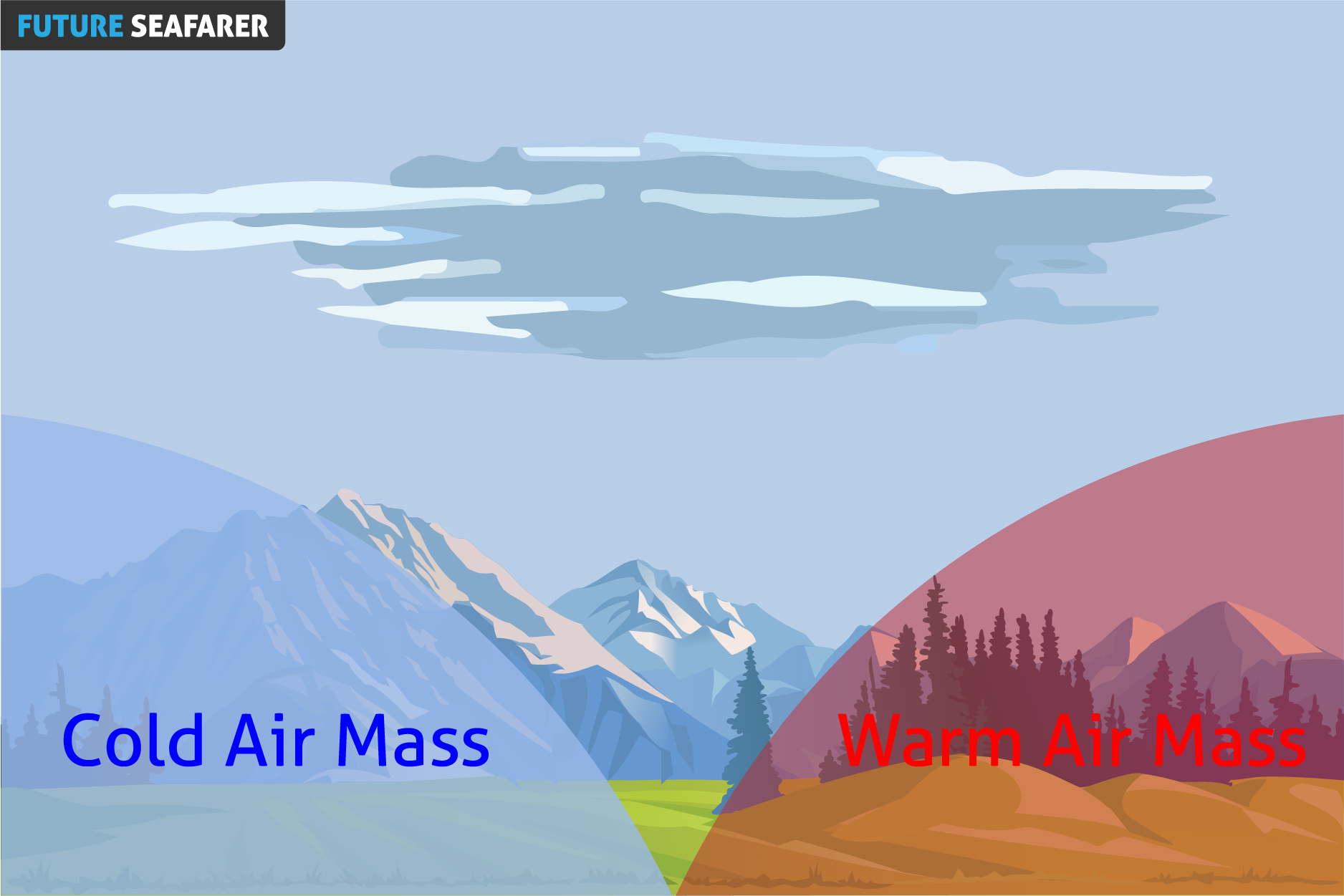
Is The Boundary Or The Transition Zone Between Two Air Masses Of Different Densities, The Air Masses Separated By A Front Usually Differ In Temperature And Humidity.
TYPES OF FRONTS:
COLD FRONT.
WARM FRONT.
OCCLUDED FRONT.
STATIONARY FRONT.
COLD FRONT
DEFINITION:
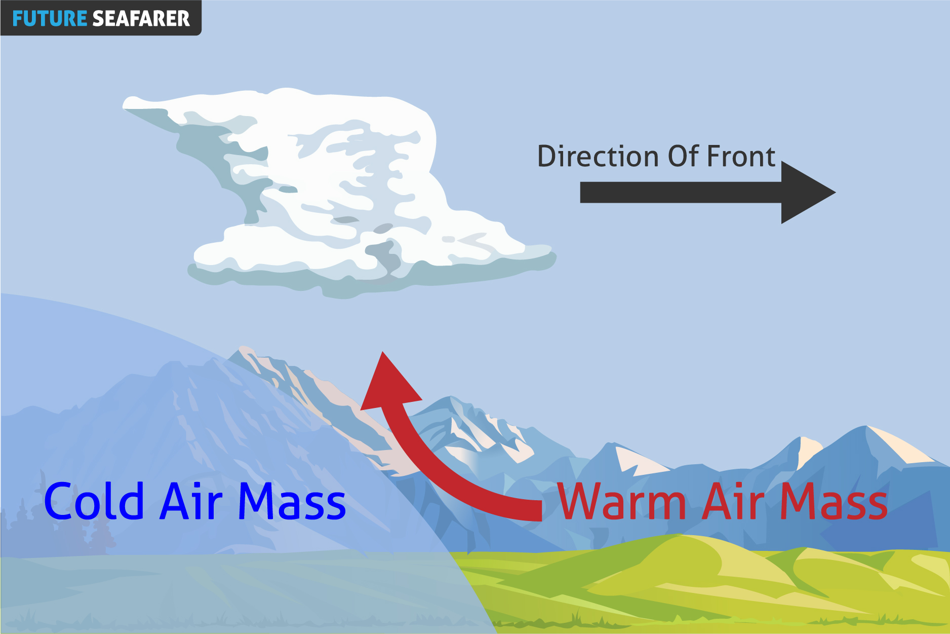
Is The Transition Zone Where A Cold Air Mass Is Replacing A Warmer Air Mass.
PROPERTIES:
Generally Moves From Northwest To Southeast.
The Air Behind It Is Colder And Drier Than The Air Ahead Of It.
The Cold Air Mass Goes Under The Warm Air Mass Due To The High Density Of Cold Front, Forcing This Warm Air To Rise Up.
Cold Fronts Are Usually Go Along With Areas Of Low Pressure.
Cold Front Moves Faster Than Warm Front.
SYMBOL ON SYNOPTIC CHART:
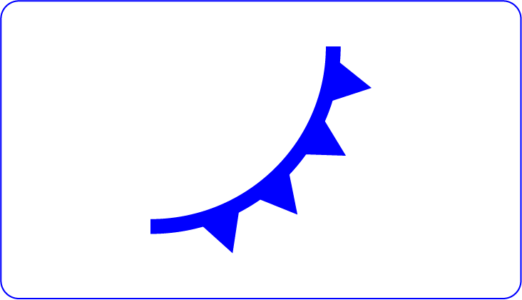
Cold Fronts Are Represented As Blue Solid Line With Triangles On A Weather Map.
The Triangles Are Pointing Towards The Warmer Air And In The Direction Of Movement.
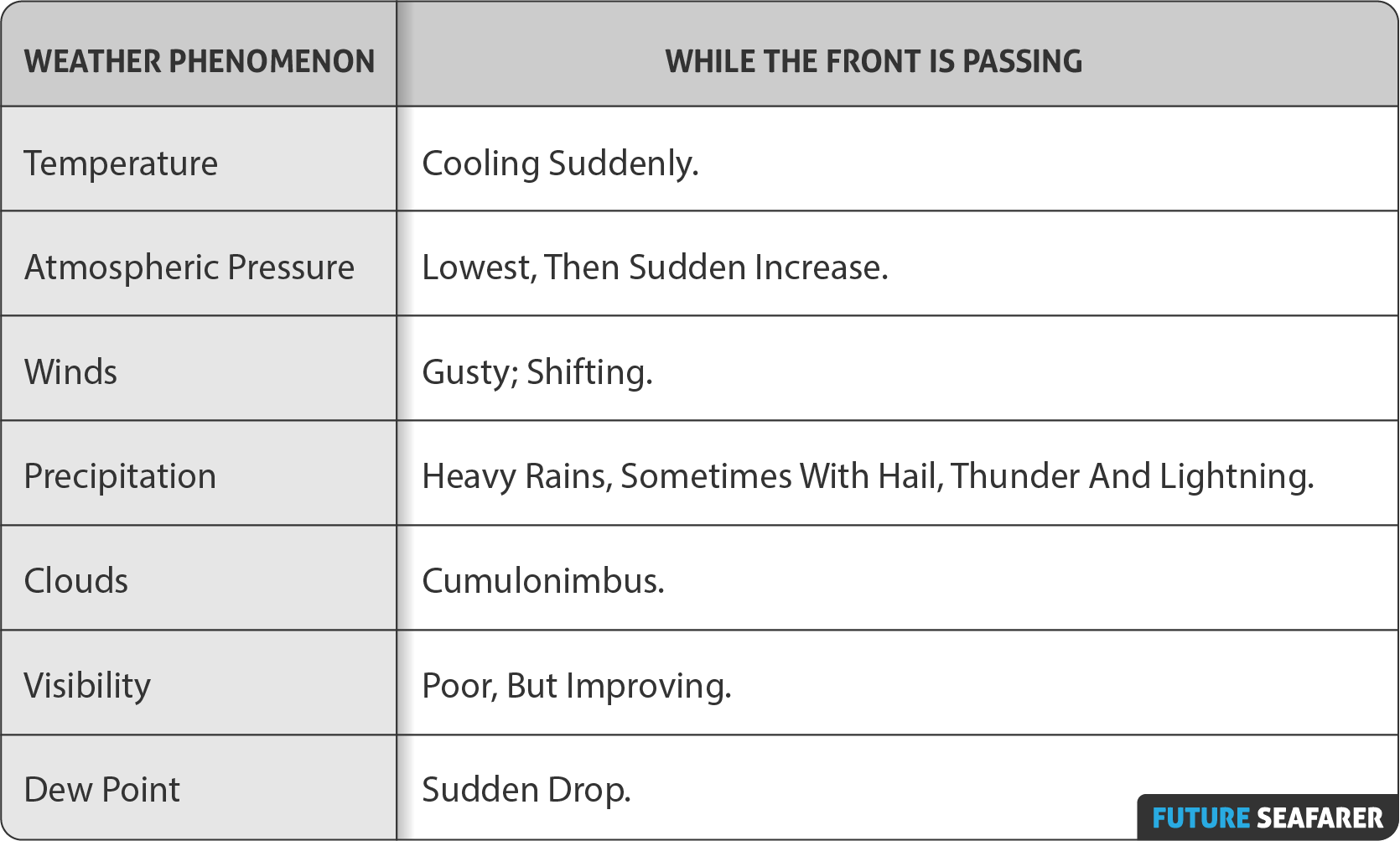
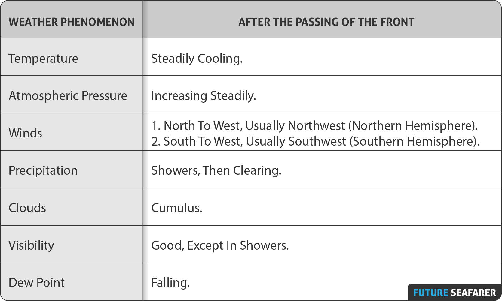
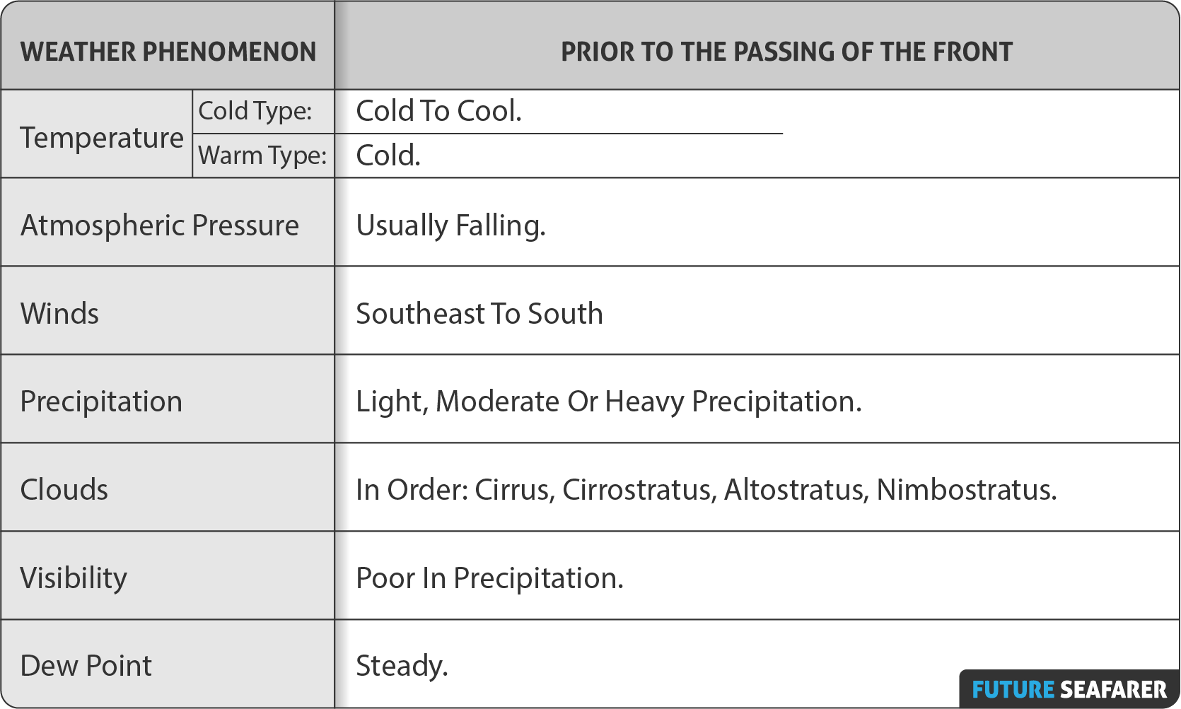
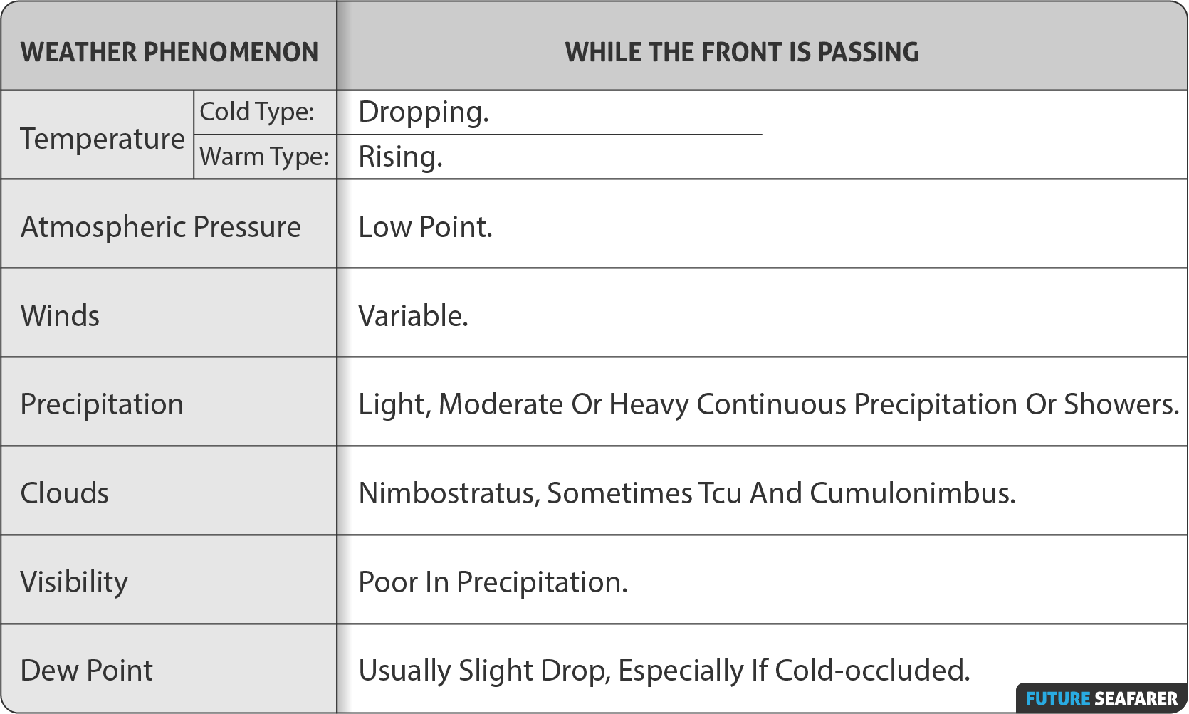
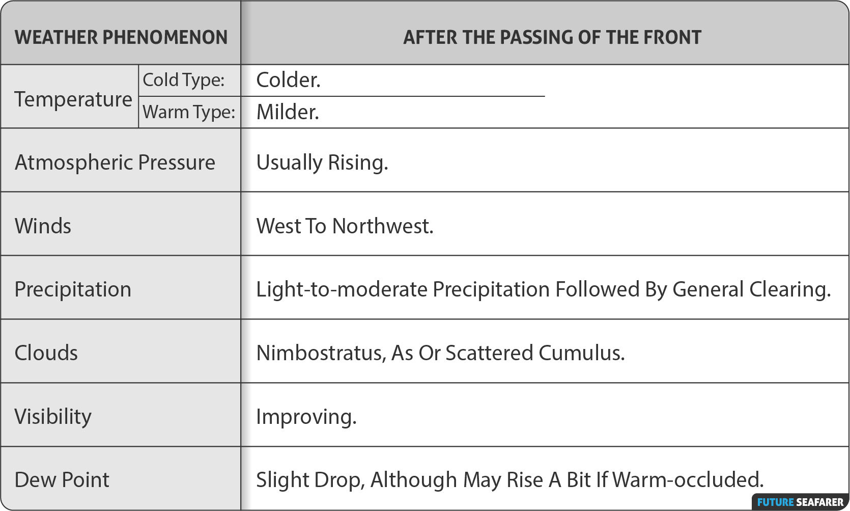
COMMON CHARACTERISTICS:
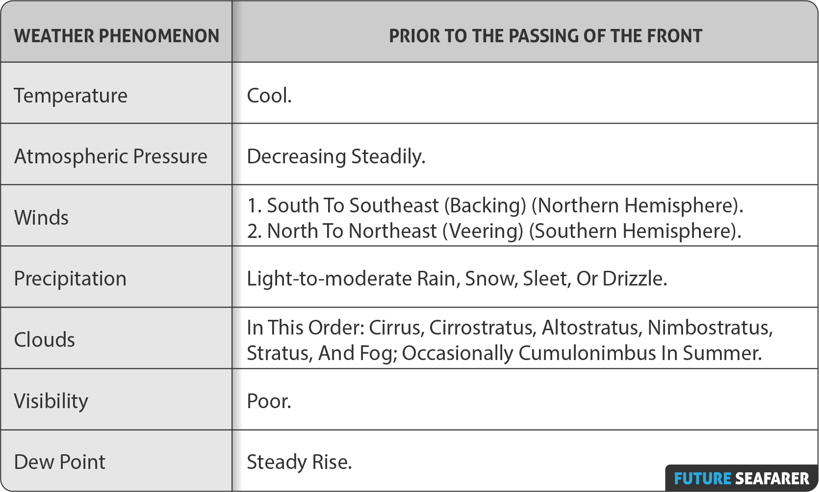
Prior to the Passing of the Front
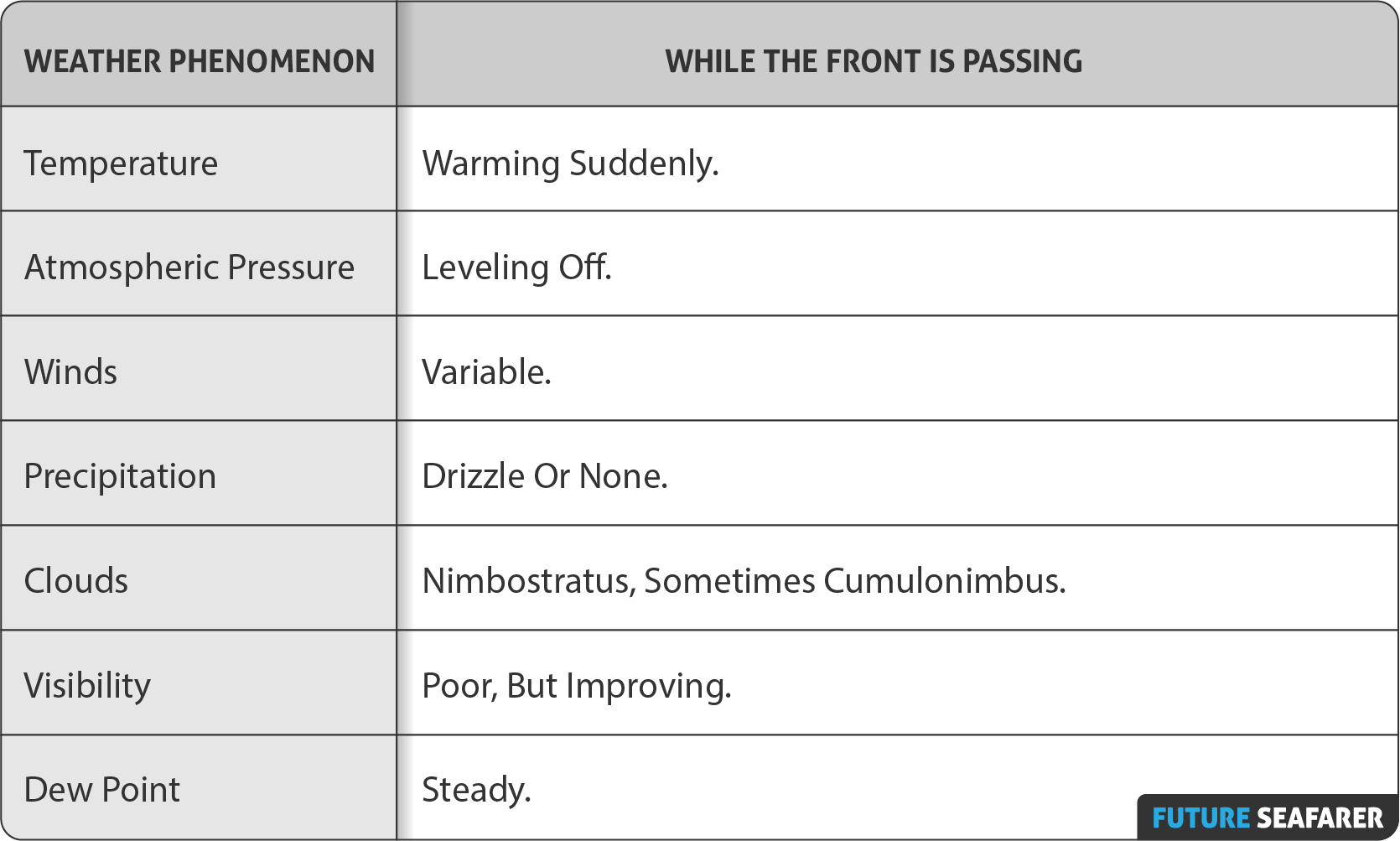
While the Front is Passing
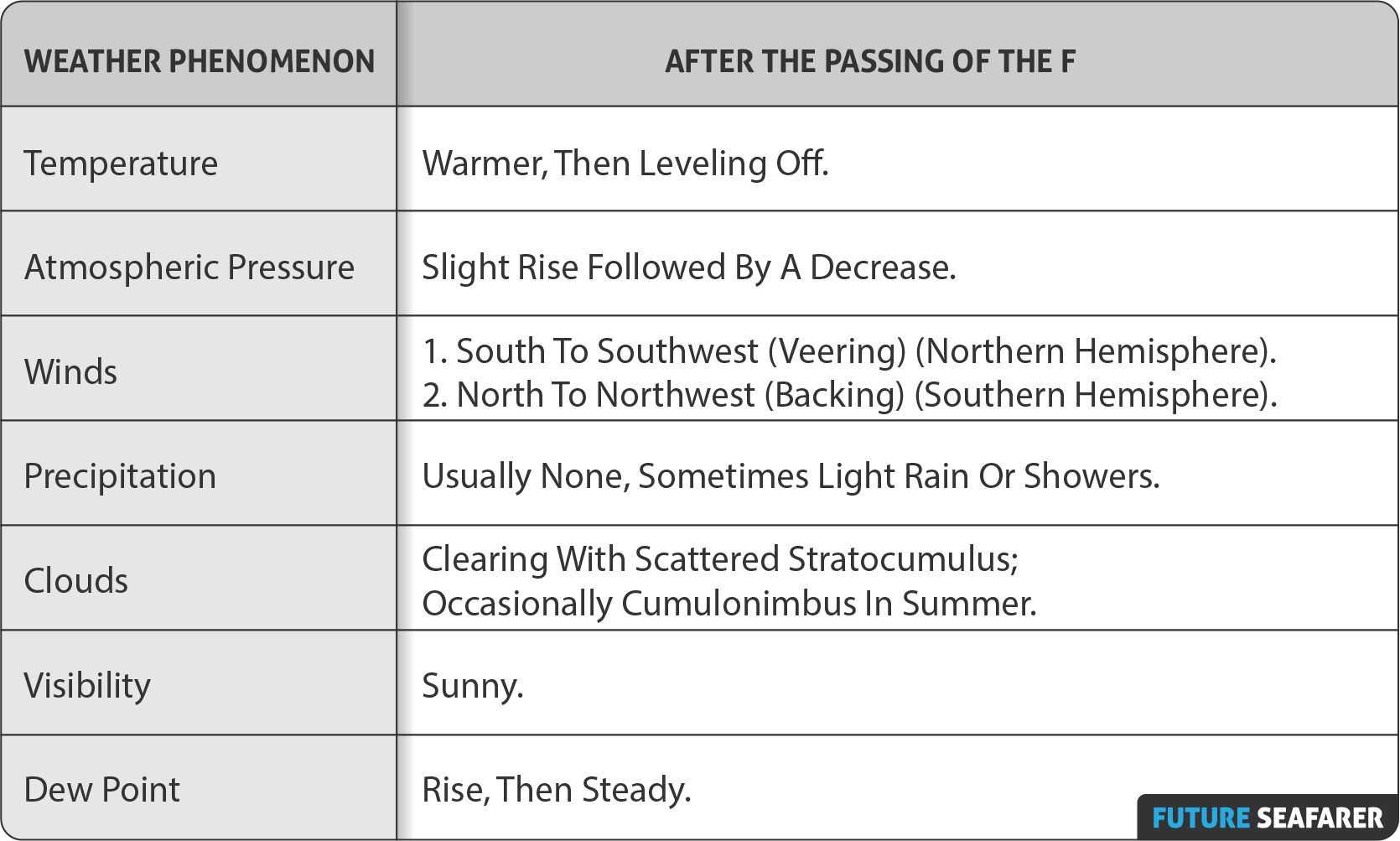
After the Passing of the Front
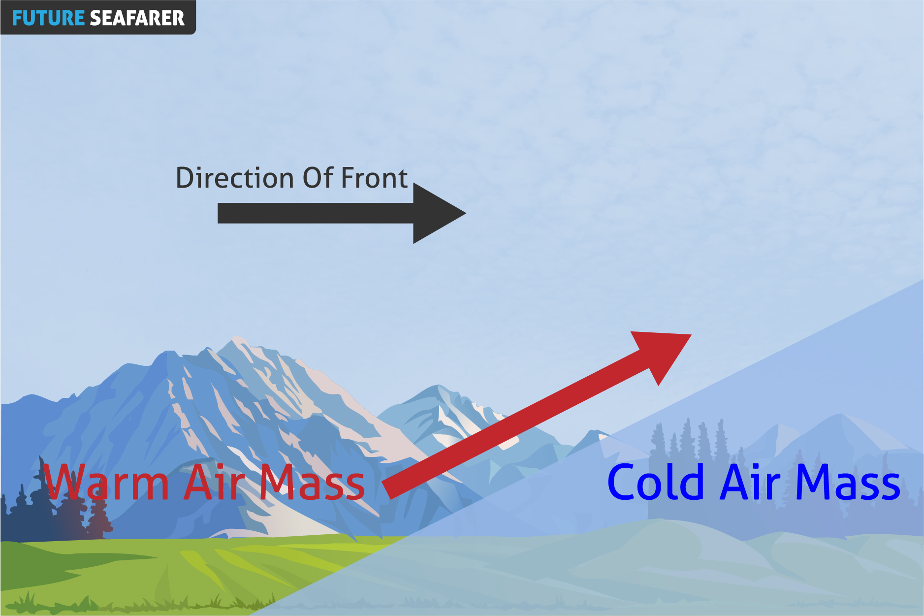
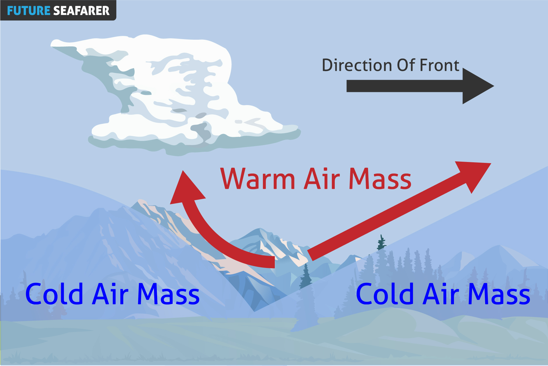
WARM FRONT
DEFINITION:
Is The Transition Zone Where A Warm Air Mass Is Replacing A Cold Air Mass.
PROPERTIES:
Generally Moves From Southwest To Northeast.
The Air Behind It Is Warmer And More Moist Than The Air Ahead Of It.
When A Warm Front Passes Through, The Air Becomes Noticeably Warmer And More Humid Than It Was Before.
Warm Fronts Lie Within Broader Troughs Of Low Pressure Than Cold Fronts.
Move More Slowly Than The Cold Fronts Which Usually Follow Because Cold Air Is Denser And Less Easy To Remove From The Earth’s Surface.
SYMBOL ON SYNOPTIC CHART:
Warm Fronts Are Represented As Red Solid Line With Semicircles On A Weather Map.
The Semicircles Are Pointing Towards The Colder Air And In The Direction Of Movement.
COMMON CHARACTERISTICS:
Prior to the Passing of the Front
While the Front is Passing
After the Passing of the Front
OCCLUDED FRONT
DEFINITION:
Is A Composite Front Formed During The Process Of Cyclogenesis When A Cold Front Overtakes A Warm Front. When This Occurs, The Warm Air Is Separated (Occluded) From The Cyclone Center At The Earth’s Surface.
PROPERTIES:
Occluded Fronts Usually Form Around Mature Low Pressure Areas.
There Are Two Types Of Occlusion, Warm And Cold:
In A Cold Occlusion, The Air Mass Overtaking The Warm Front Is Cooler Than The Cool Air Ahead Of The Warm Front, And Plows Under Both Air Masses.
In A Warm Occlusion, The Air Mass Overtaking The Warm Front Is Not As Cool As The Cold Air Ahead Of The Warm Front, And Rides Over The Colder Air Mass While Lifting The Warm Air.
The Trowal (Short For Trough Of Warm Air Aloft) Is The Projection On The Earth’s Surface Of The Trough Of Warm Air Aloft Formed During The Occlusion Process Of The Depression.
SYMBOL ON SYNOPTIC CHART:
Occluded Fronts Are Represented As Purple Solid Line With Alternating Triangles And Semicircles On A Weather Map.
The Alternating Triangles And Semicircles Are Pointing Towards The Direction Of Movement Of The Front.
COMMON CHARACTERISTICS:
Prior to the Passing of the Front
While the Front is Passing
After the Passing of the Front
STATIONARY FRONT
DEFINITION:
Is A Pair Of Air Masses, Neither Of Which Is Strong Enough To Replace The Other.
Or
When A Warm Or Cold Front Stops Moving, It Becomes A Stationary Front.
PROPERTIES:
They Tend To Remain Essentially In The Same Area For Extended Periods Of Time, And Waves Sometimes Propagate Along The Frontal Boundary.
When There Is A Lot Of Water Vapor In The Warmer Air Mass, Significant Amounts Of Rain Or Freezing Rain Can Occur.
If One Air Mass Enters The Other, Then It Will Change Into A Cold Or Warm Front, And The Stationary Front Will Be Classified As Moving.
A Noticeable Temperature Change And/or Shift In Wind Direction Is Commonly Observed When Crossing From One Side Of A Stationary Front To The Other.
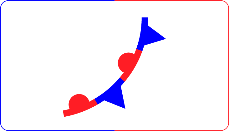
SYMBOL ON SYNOPTIC CHART:
Stationary Fronts Are Represented As Red And Blue Solid Lines With Alternating Blue Triangles And Red Semicircles On A Weather Map.
The Blue Triangles Pointing Towards The Warmer Air And Red Semicircles Pointing Towards The Colder Air.