Обучайся морскому делу и открывай новые горизонты вместе с Вавада
.DEFINITION:
In Meteorology, A Cloud Is An Aerosol Comprising A Visible Mass Of Liquid Droplets Or Frozen Crystals Made Of Water Or Various Chemicals. On Earth Clouds Are Formed By The Saturation Of Air In The Homosphere When Air Cools Or Gains Water Vapor.
CLASSIFICATION OF CLOUDS:
The World Meteorological Organization (WMO) Has Extended Luke Howard’s Classifications To Make 10 Main Groups Of Clouds, Called Genera.
THESE GROUP ARE DIVIDED INTO THREE LEVELS, WHICH THEY ARE:
- Cloud High (CH).
- Cloud Medium (CM).
- Cloud Low (CL).
CLOUD HIGH (CH)
This Group Of Clouds Will Be Found At Altitude Of 7000 Meters (23,000 Ft) And Above
THIS GROUP OF CLOUDS CLASSIFIED INTO 3 MAIN GROUP OF CLOUDS WHICH THEY ARE:
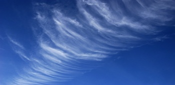
1. CIRRUS:
- Abbreviation: Ci.
- Appearance: Cirrus Tends To Be Wispy And Are Mostly Transparent Or Translucent.
- Precipitation Cloud: Isolated Cirrus Clouds Do Not Bring Rain.
- Large Amounts Of Cirrus Clouds Can Indicate An Approaching Storm System Eventually Followed By Fair Weather.
REFERENCES: WIKIPEDIA
2. CIRROCUMULUS
- Abbreviation: Cc.
- Appearance: Small, High, Patched Clouds, In Rows.
- Precipitation Cloud: Together With Other Cirriform Clouds Meaning Rain In Around 10 Hours.
- May Form Ahead Of A Frontal System.
REFERENCES: WIKIPEDIA
3. CIRROSTRATUS
- Abbreviation: Cs.
- Appearance: White Veil.
- Precipitation Cloud: No.
- Usually Signal The Approach Of A Warm Front.
REFERENCES: WIKIPEDIA
CLOUD MEDIUM (CM)
This Group Of Clouds Will Be Found At Altitude Between 2000m And 7000m (6500ft To 23,000ft)
THIS GROUP OF CLOUDS CLASSIFIED INTO 3 MAIN GROUP OF CLOUDS WHICH THEY ARE:
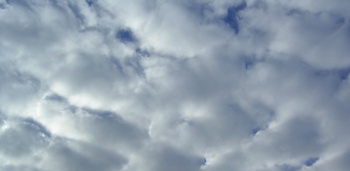
1. ALTOCUMULUS
- Abbreviation: Ac.
- Appearance: Similar To Cirrocumulus, But Individual Segments Are Larger And Darker.
- Precipitation Cloud: No.
- Frequently Signals The Development Of Thunderstorms Later In The Day.
REFERENCES: WIKIPEDIA
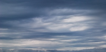
2. ALTOSTRATUS
- Abbreviation: As.
- Appearance: Sheet Or Layer, Can Usually See The Sun Through It.
- Precipitation Cloud: Rain Possible In Thickened Clouds.
- Classification Is Changed To Nimbostratus If Rain Becomes Persistent.
REFERENCES: WIKIPEDIA
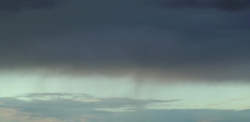
3. NIMBOSTRATUS
CLOUD LOW (CL)
This Group Of Clouds Will Be Found At Altitude Below 2000m (6500ft)
THIS GROUP OF CLOUDS CLASSIFIED INTO 4 MAIN GROUP OF CLOUDS WHICH THEY ARE:
1. STRATUS
- Abbreviation: St.
- Appearance: Horizontal Layers With A Uniform Base.
- Precipitation Cloud: Drizzle, Freezing Drizzle Or Snow Grains.
- These Clouds Are Essentially Above-ground Fog Formed Either Through The Lifting Of Morning Fog Or Through Cold Air Moving At Low Altitudes Over A Region.
REFERENCES: WIKIPEDIA
2. CUMULONIMBUS
- Abbreviation: Cb.
- Appearance: Very Tall And Large Clouds, Like A Tower.
- Precipitation Cloud: Yes, Often Intense.
- Capable Of Producing Lightning And Other Dangerous Severe Weather.
REFERENCES: WIKIPEDIA
3. CUMULUS
- Abbreviation: Cu.
- Appearance: “Puffy” Or “Cotton-like” And Have Flat Bases.
- Precipitation Cloud: Little Or No Precipitation.
- Generally Cool The Earth By Reflecting The Incoming Solar Radiation.
REFERENCES: WIKIPEDIA
4. STRATOCUMULUS
- Abbreviation: Sc.
- Appearance: Much Like Cumulus Clouds, Except All Lumped Together And Bigger.
- Precipitation Cloud: Most Often Produce No Precipitation, And When They Do, It Is Generally Only Light Rain Or Snow.
- These Clouds Are Often Seen At Either The Front Or Tail End Of Worse Weather.
REFERENCES: WIKIPEDIA


